Daily Weather Forecasts
Ocean Surface Currents
Optimum Route
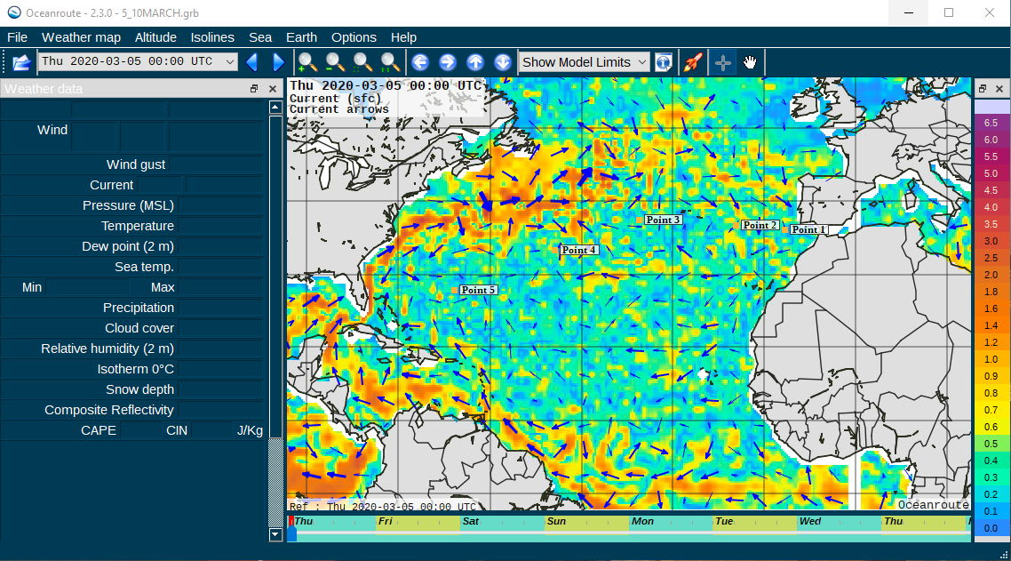
Weather Forecast Software
Historic Voyage Analysis
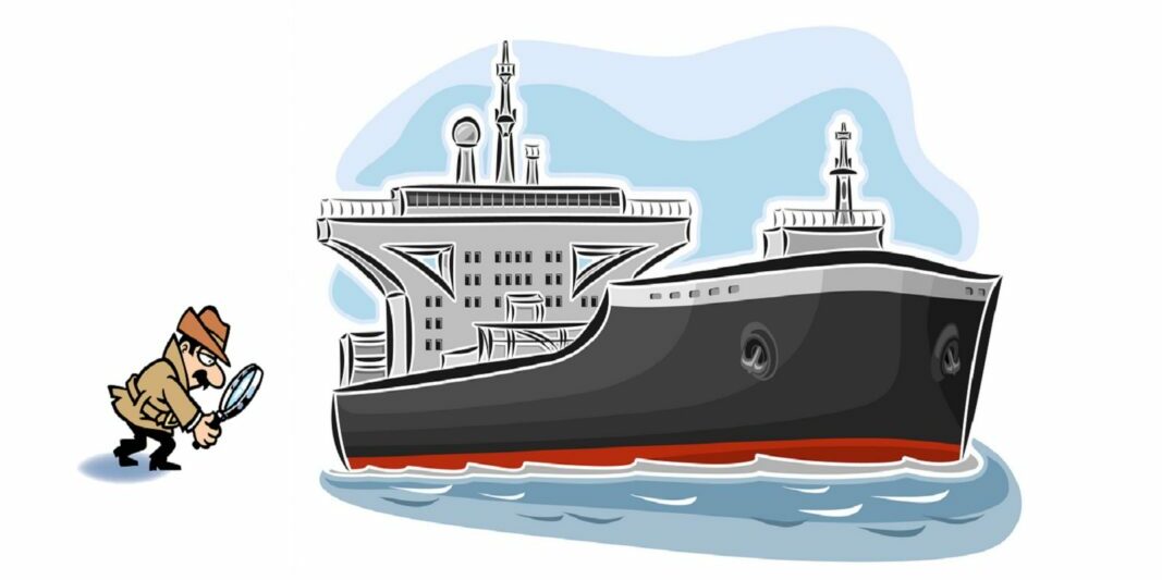
Shadow Monitoring
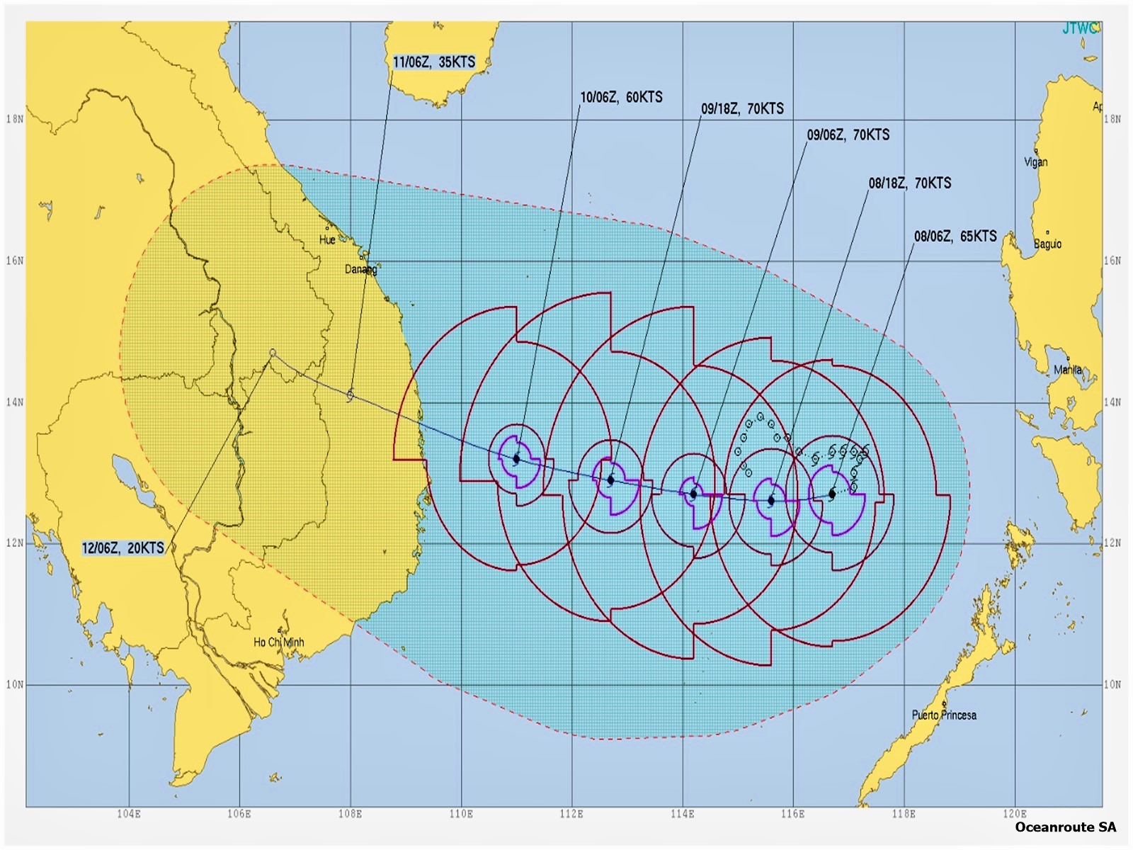
Tropical Storm Advisories
Speed and Consumption Disputes.
Weather Conditions at Ports
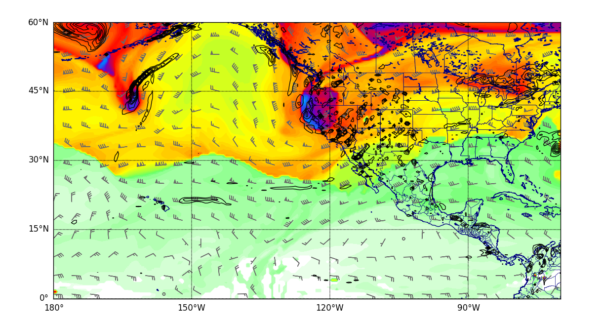
Daily Weather Forecasts
Weather forecast (Wind, Pressure, Swell and Significant Wave)
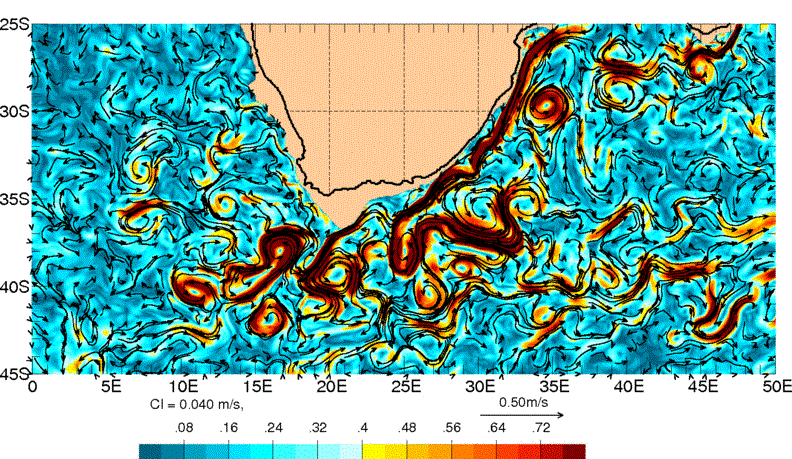
Ocean Surface Currents
Ocean Surface Currents Forecast & Reanalysis
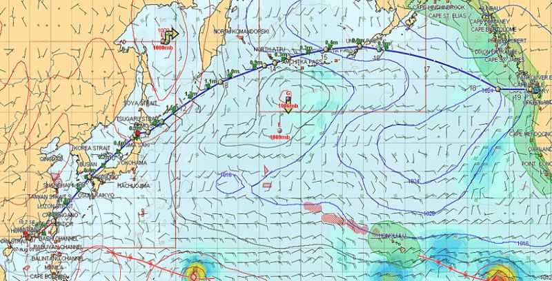
Optimum Route
Recommended Route prior Commencement of Sea Passage
Weather Forecast Software
Our Weather Forecast Software available to our Clients with annual Contracts
Historic Voyage Analysis
Reconstruction of any historic passage within the last 10 years.

Shadow Monitoring
Monitoring and evaluation of the actual performance of any ship against her promising speed & consumption figures
Tropical Storm Advisories
Tracking and Forecasting of tropical cyclones (depressions, storms, hurricanes, typhoons)
Speed and Consumption Disputes.
Legal advice on Speed and Consumption Disputes.
Guidance on the Weather Routing clauses & Performance Warranties of the c/p

Weather Conditions at Ports
-
Hourly Data for present and historic Weather Conditions at ports. Ideally for Voyage Charter and Laytime Calculations