
OCEAN CURRENTS AND WAVES
CURRENTS
Ocean currents are streams of water flowing both near surface but also far below it. Horizontal movements are called currents while vertical movements are called upwellings/downwellings. Surface currents are created by prevailing winds which blow over the ocean pushing the water along. As winds pushing the water away, deep cold currents rise to take its place. This upwelling of deep, cold water moves nutrients from ocean’s bottom to the surface resulting in nourished food for fish. This happens due to differences in seawater density. Water’s density depends on its temperature and salinity. The colder and saltier the water is, the denser and heavier it becomes. Cold and dense water then sinks and flows under warmer, lighter water creating a current. The Earth’s rotation from west to east cause ocean currents to veer right in the northern hemisphere (N.H.) and left in the southern hemisphere (S.H.). This deflection, known as Coriolis effect, makes surface currents flow clockwise in a circular pattern in the N.H. and anticlockwise in the S.H.
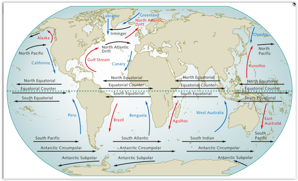
The world’s large ocean currents are also influenced by the prevailing winds. Warm ocean currents are red, and cold currents are shown in blue.
FAMOUS WORLDWIDE OCEAN CURRENTS
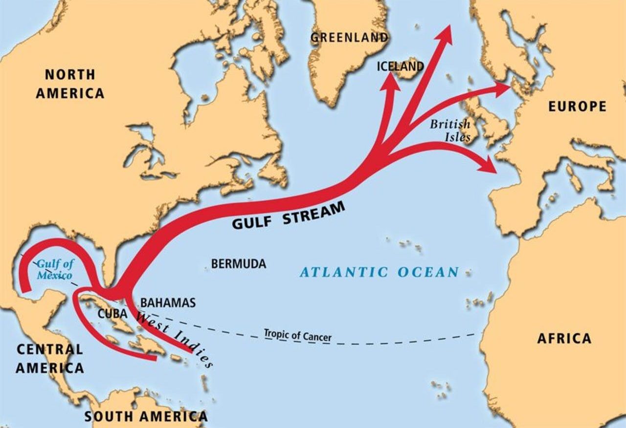
Gulf Stream is one of the most famous ocean currents in the world. This current is warm and flows from Gulf of Mexico up to eastern coast of US and Canada before spreading to the Atlantic Ocean heading northwards. Gulf Stream is enormous and very powerful. It measures up to 80km in width and it is more than 1km deep. Due to the strength of Gulf Stream , northern Europe is also inhabitable even though it is close to the Arctic. Countries like Great Britain, Scandinavia and Russia would have been icy cold if Gulf Stream was absent. Consequently, Gulf Stream plays a major role in climate.
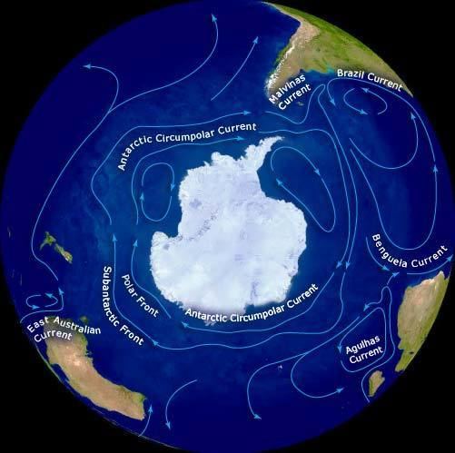
The Antarctic Circumpolar Current (ACC) is the largest ocean current in the globe. It starts from the Antarctic and flows eastward towards south Atlantic, Indian and Pacific Oceans. The ACC is a relatively slow current but transports greater amounts of water than any other current. As the deep and cold water travels through warmer climates, it mixes with warmer water. As the cold water sinks below, the warm water rises creating a slow upwelling bringing nutrients to the surface as mentioned before. Westerly winds are very strong in the Antarctic which drive the eastward flow of the ACC. Due to this, the ACC is historically referred to as the ‘West Wind Drift’.
Other known, important but smaller currents are: Kuroshio current, Peru (Humboldt) current, California and Labrador current.
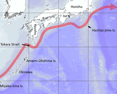
Kuroshio current or Japan current is similar to Gulf Stream but in the Pacific Ocean. It is fast, relatively deep and narrow. It transfers warm tropical water northwards towards the polar region. The warm waters of Kuroshio current are vital for the coral reefs of Japan which are the northernmost coral reefs in the world.
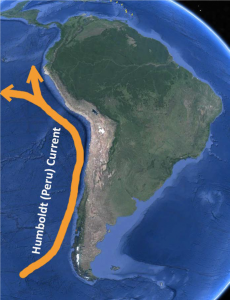
Peru current or Humbolt current is a relatively slow and shallow current of the southeast Pacific. It is reinforced by the West Wind Drift and it is a cold current apart from the times when El Nino takes place. Peru Current brings coastal fog but it also brings moisture to one of the most arid regions in the world. The cold flow is intensified by upwelling of deep water full in nutrients which in combination with the sun, allows rich plankton to grow. This is why Peru, Chile and Equador coasts are famous for their fishing grounds for anchovies and tuna.
The California current flows southward along the west coast of North America. It is considered as a major current associated with strong upwelling zones supporting abundant plankton and animal life. California Current is a continuation of the Kuroshio current from Japan which causes an outland transport of cool water from high latitudes along the California coast to make this area highly productive.
The Labrador current is cold in the North Atlantic and flows southwards along the western side of the Labrador Sea. The current passes along the eastern coasts of Canada. It carries a significant amount of water but also numerous icebergs southwards. Labrador current was responsible for carrying the famous iceberg which led to Titanic’s shipwreck in 1912. Additionally, the cold Labrador current can create ship navigational problems as in the regions where the cold current meets the warm from the Gulf, fog forms and can be quite thick. On the other hand, Labrador Current is quite important as its cold waters (<0oC) and its low salinity support the diversity of sea life including the famous Atlantic Cod and American plaice.
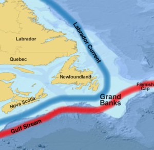
Europe is mostly affected by Gulf Stream and Labrador Current. Climate change could reduce the flow of both Gulf Stream and Labrador Current leading to a diversion towards NW Atlantic. This diversion could lead to colder climates for northern Europe and milder winters in Canada’s eastern coastal areas. However, the melting of Arctic ice will load more waters to Labrador Current making it slower and at the same time threatening due to the sea level rise.
The above mentioned currents are some of the most significant ones globally. Of course there are loads of currents and a list of them can be found below:
List of Ocean Currents of the World
| Name of Current | Nature of Current |
| North Equatorial Current | Hot or Warm |
| Kuroshio Current | Warm |
| North Pacific Current | Warm |
| Alaskan Current | Warm |
| Counter Equatorial Current | Warm |
| El Nino Current | Warm |
| Tsushima Current | Warm |
| South Equatorial Current | Warm |
| East Australian Current | Warm |
| Humboldt or Peruvian Current | Cold |
| Kuril or Oya shio Current | Cold |
| California Current | Cold |
| Antarctica Current | Cold |
| Okhotsk Current | Cold |
| Florida Current | Warm |
| Gulf Stream | Warm |
| Norwegian Current | Warm |
| Irminger Current | Warm |
| Rannell Current | Warm |
| Antilles Current | Warm |
| Brazilian Current | Warm |
| Labrador Current | Cold |
| Canary Current | Cold |
| Eastern Greenland Current | Cold |
| Benguela Current | Cold |
| Antarctica Current | Cold |
| Falkland Current | Cold |
| Mozambique Current | Warm and Stable |
| Agulhas Current | Warm and Stable |
| South-West Monsoon Current | Warm and unstable |
| North-East Monsoon Current | Cold and unstable |
| Somali Current | Cold and unstable |
| Western Australian Current | Cold and Stable |
| South Indian Ocean Current | Cold |
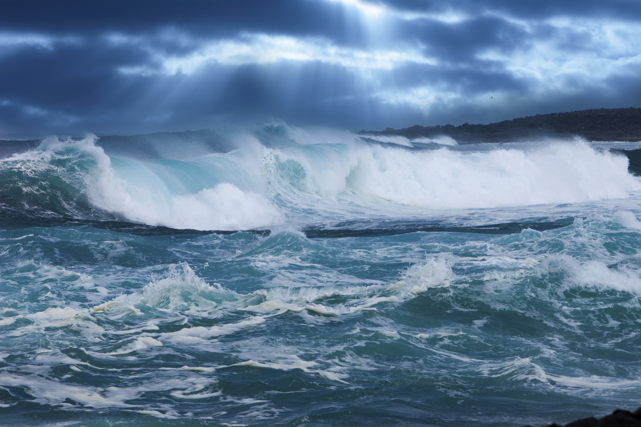
WAVES
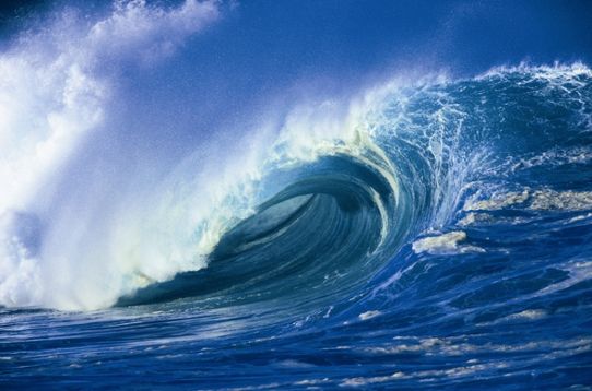
A wave is a ridge on the water surface and it usually has a forward motion. However, inside the waves the water mass moves in a circular motion and it’s only the wave energy that moves forward. There are several types of waves but on this chapter we will talk about wind waves, swells and rogue waves.
WIND WAVES
When wind blows over a water surface, waves can be created. However, wave height depends on wind speed, duration (how long the wind blows) and fetch. Fetch is the distance over water that wind blows in a single direction across the surface without disruption from obstacles. For big waves to form we need to have a combination of all three factors like great wind speed, long duration and big fetch. If the wind duration and fetch are long enough, the sea becomes ‘fully developed’ and reaches a steady state. The waves have then reached a maximum size for that wind speed. In deep water, particles move in a circular motion when the waves pass. The greater the depth, less the movement of water which becomes very small at depths more than half the wave length.
Waves at sea are usually a combination of several wave systems that have waves of different length and height. The wave height is calculated by measuring the average of the wave height of the top third of the waves – which means we need to measure all the wave heights to find out the ones that are in the highest 33%. This wave height is called significant wave height and is used in nautical meteorology forecasting.
However, the tallest waves could reach 1.6-1.8 times the significant wave height and individual waves can reach twice the significant wave height.
When the wind dies out, it usually takes 5 hours till the last large wave has passed and 10 hours before waves with height as same as the significant height have passed.
When at sea, and you see waves starting to increase, windy weather is on its way!
SWELLS
Swells are the waves that are produced by far away storms (raging hundreds of miles out to sea) and combined with the wind waves can give high wave heights. Of course they can also appear suddenly on a calm sea. Like we mentioned before, the longer the fetch, the stronger the wind and the longer the wind duration, then the further away the swell can travel.
Near storms and deep low pressure systems, the vigorous air movement lead to strong to gale force winds. As wind blows over the sea surface, friction takes place and energy is transferred from wind to water resulting in a rising wave crest. As time passes, a large amount of energy can be built below ocean’s surface resulting in deeper and higher waves. This energy gives power to swells so they can travel long distances over the ocean. As swells move away from their primary region, they become rounded and flatten. There are variations in the height of each swell. Swell height is usually the average height of the tallest one third of waves in a swell collection. Like the wind waves, swell direction is the direction where the swell is coming from. A collection of ocean swells can move in any direction over the ocean and this can of course be different to the wind direction of the region.
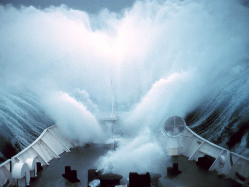
ROGUE WAVES
A rogue wave or freak wave is the highest and most dangerous wave that can be encountered at sea. It is two times higher than the significant wave height. Thus, a rogue wave is a lot bigger than the other waves happening at the same time. Rogue waves can form anywhere but they can be seen more often in the Atlantic, North Sea and even more frequently off the southeast coast of South Africa. The biggest wave observed is 30m. Obviously, rogue waves are considered rare but pretty dangerous causing significant harm to big oceangoing vessels.
They can mainly form when a swell interacts with the current in the area. One typical example is in the southeast Africa when large ocean swells can meet with the fast-moving Agulhas current. The current can intensify wave’s energy, making the wave more powerful. Rogue waves can also form from eddies. Eddies are generated along the edges of currents that flow in a different direction than the main current. Eddies can travel for long time across the oceans being organized into eddy fields. These eddy fields have much more kinetic energy than the currents themselves. In the immediate vicinity of currents where eddies are present, rogue waves can form.
Author: Triantafyllia Sideri / Operational Meteorologist